Over the years, I have utilized my designer, producer, and journalist skills to aggregate and digest information and design and build projects to create visually compelling reporting and storytelling. This includes mapping, interactive video and photography, and data visualization. I have used third-party tools like Flash, Canva, and Tableau and commissioned original tools for content management systems.
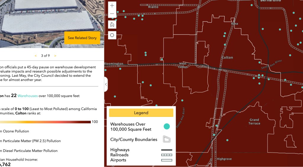
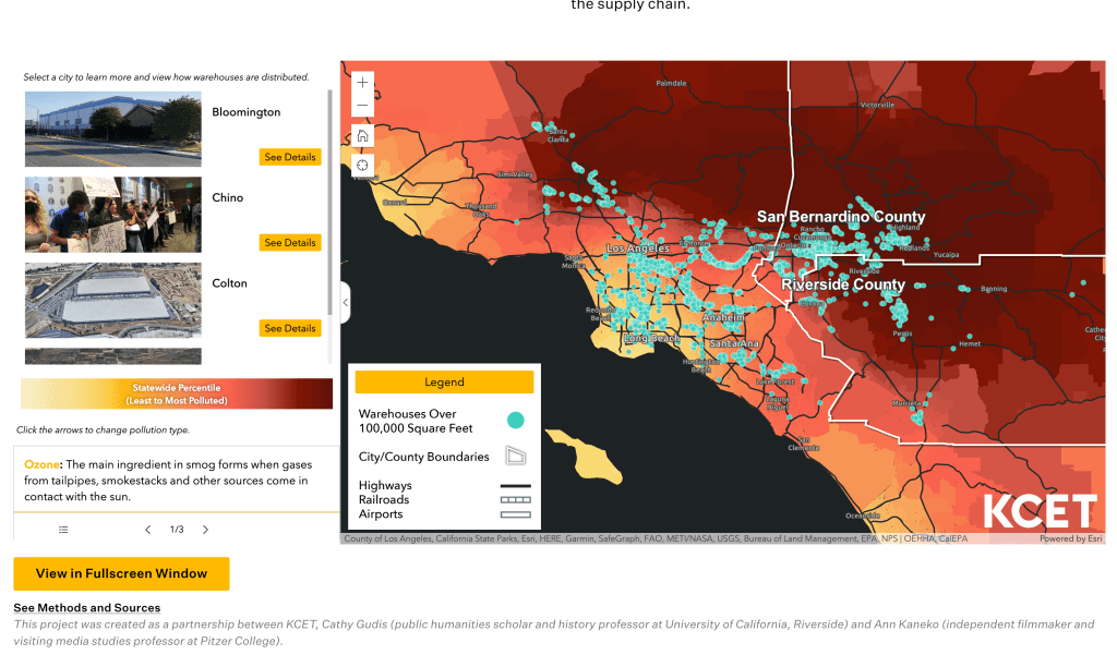
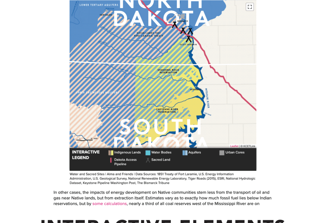
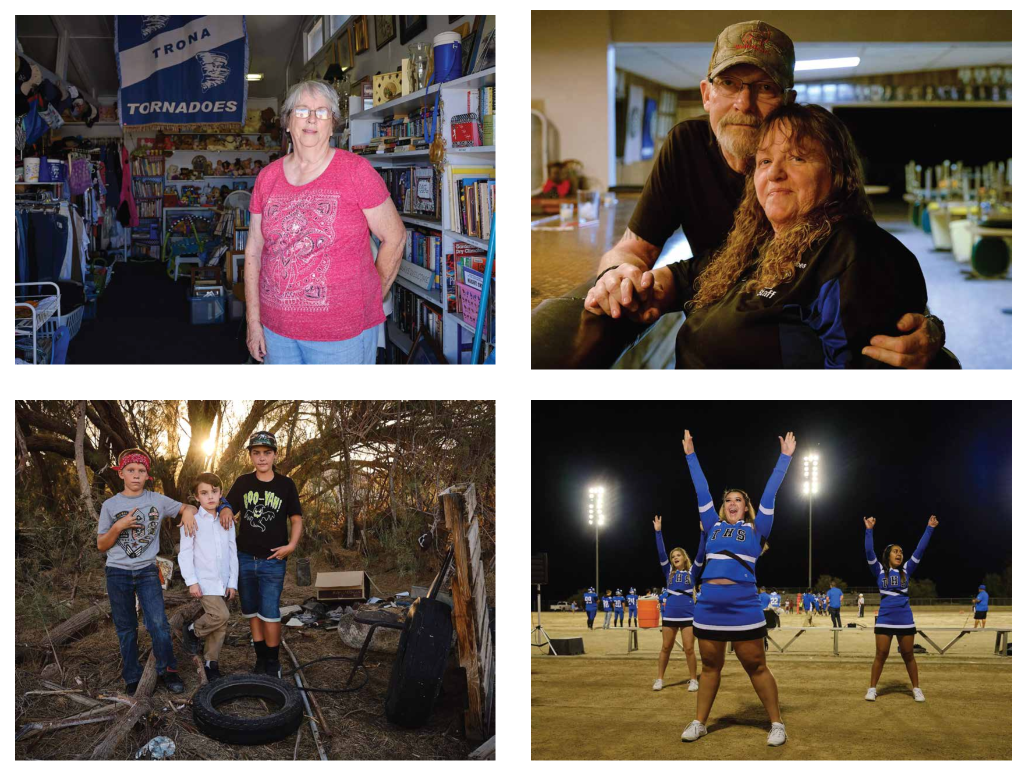
Some notable projects include field guides to the Los Angeles River in which we aggregated access points, walking trails, and amenities along 51 miles of the river; mapping pollution in the Inland Empire in which we sourced public information and used GIS to map it; and audio/photography portraits of residents in Northeast Los Angeles.


You must be logged in to post a comment.